Words by Brandon Herbert
Body Photos by Brandon Herbert and Dakota Duncan
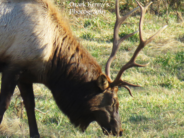
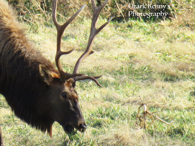
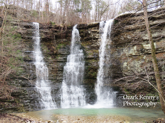
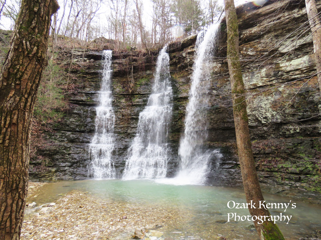
Slideshow Photos by Ozark Kenny
Interestingly enough, I have never been on what one would call a "real hike" in a while. Better said, in the last few years, I haven't left the house with the sole intention of walking down a specific trail. Odd, since I've lived in Arkansas for so many years and to have not done so often would be a offense to some cultures around here. So, when my ever-friendly neighbor, who I only knew as 'Kenny', asked me to go on a hike, I said: "Sure, why not?" but I can tell you that I had no idea what I was in for.

I had known that I knew Kenny's son, Dakota, from my days riding for/assisting the former Syndicate Boards & Apparel back in the day and was pumped to get to hang with him again. When I found out I could make the trip, I was stoked and spent the early parts of the morning scrambling to get ready for our 8am departure. Feeling under-prepared, I loaded myself up anyways and rolled out with this tenacious dad-son hiking duo.

Once we set off on the road, I noticed that the vehicle was stocked with outdoor books and maps of Northwest Arkansas with bookmarks and notes about specific locations. On our way, Kenny mentioned he had a calendar showcasing of some of his photography. I picked it up and got to ingest some of his work, noted on the front cover by 'Ozark Kenny'. As we progressed I was asked the question: "Would you like to go somewhere a little more difficult than we planned?". I thought to myself "Difficult walking? How difficult could it be?". Dakota reached back and grabbed a Tim Ernst book describing the Indian Creek Trail as one of the most cited accidents or injuries of any most other trails in Arkansas, or something to that affect.

Being a curator of rad content and activity, I was quick to say yes. Anything that could hurt me if I didn't do it right is usually appealing to me. As we drove east on US-412, I was familiar with my territory all too well. From frequent trips out to Eureka Springs skate park or the seldom runs out to Harrison's small downtown skate park, I knew the road, but anytime you make the turn on to south 21 towards Kingston, you know you're in for something fun. That area just oozes the feels of Arkansas, probably known to most by for Buffalo River access points.

Along the way, we were on the constant watch for eagles and elk, which we managed to stumble across a few herds of elk, to and fro. Passing the Boxley/Ponca trail areas made me think about some of the Gnarkansas crew being there days before and my true thought was "I'm so stoked that we all are engaging with Arkansas so regularly these days.". It honestly made me reminiscent of the old skate days of Gnarkansas. But still, we were getting out in Arkansas and that was the major point.

We stopped off at Twin Falls to take a look at water flow before and it told us what we wanted to know, waters were flowing! The mist coming off of the falls was so refreshing, even in the upper 40 degree weather. We took a moment to soak it in, take some pictures and rolled out, on our way to our trail head.

Kyle's Landing was our destination as we set out through the Ponca Wilderness Trails. Kenny and Dakota were obviously experienced in that in a moments notice, they were trail ready. I was prepared for that so I was as well. We took off, without maps in hand, to this roughly 6 mile hike and with the wet weather of January, we were in for some action.

AllTrails calls it a 659 feet elevation gain but quite honestly, there was no telling how much we did since, as Dakota stated in the beginning, they looked at themselves as trailblazers. We did just that. We trekked on for a few miles as I soaked up the healthy conversation with Kenny and Dakota. Since Kenny assured us that he knew exactly how to get there, Dakota and I had nothing but faith in a father's wisdom. I can say that the distance of back-tracking was minimal, nearly unnoticed.

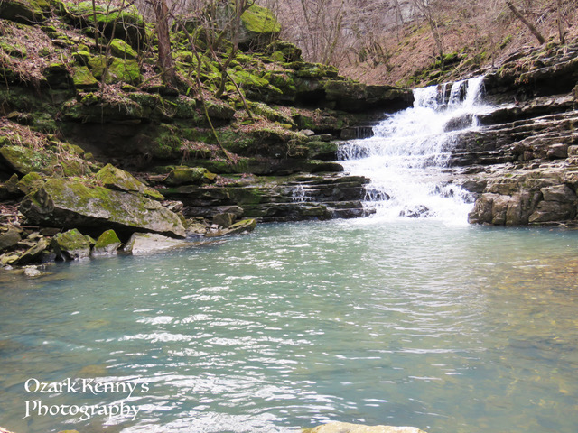
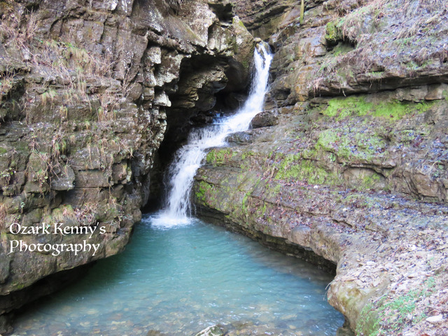
Once we reached the Indian Creek Trail, it really was smooth sailing. We passed a couple of empty campsites along the way but overall we had the trail to ourselves. Not too long from our departure, we reached our first destination: Copperhead Falls, which did not disappoint. Little did I know this was just the tip of the iceberg.

We stopped to drop bags and pulled out the cameras and went to snapping. I was pretty proud of the one above since I don't fancy myself as a photographer, but it happened. Dakota, Kenny and I spaced out for our own perspectives, went silent as we worked and met back up seamlessly with bags packed and ready to roll out to the next location.

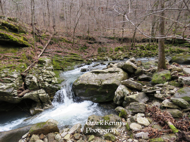
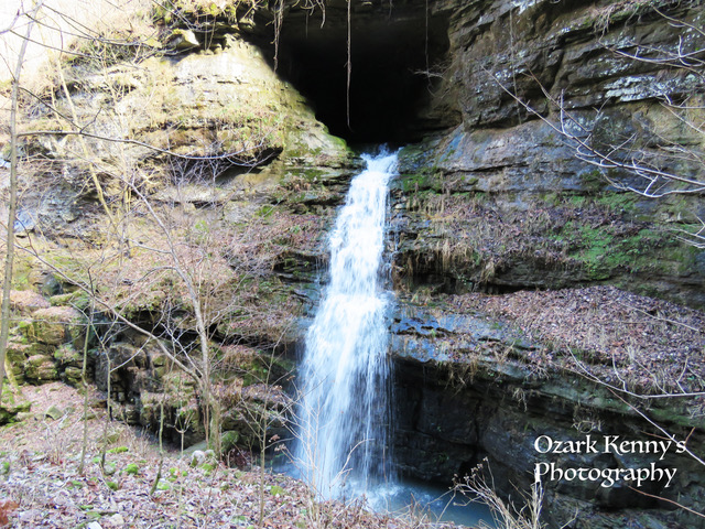
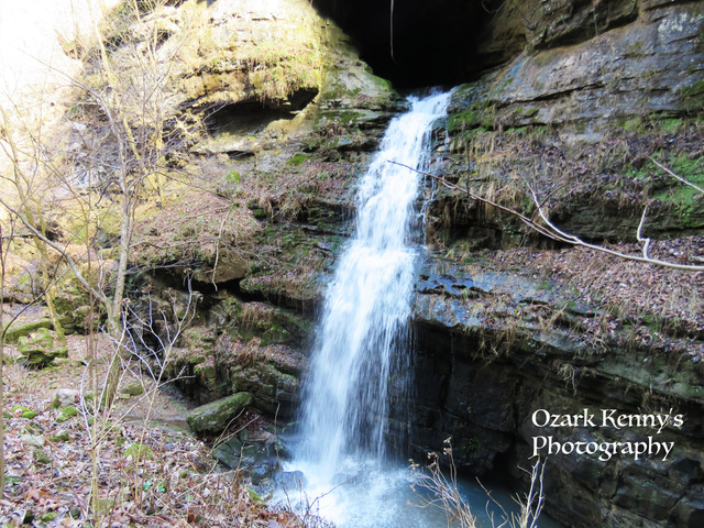
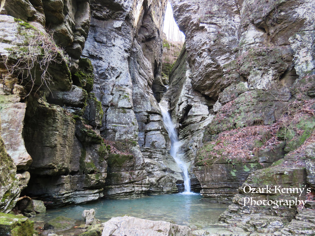
On our way in, we ended up choosing a route that kept us low near the creek bed but on the way back, we took the high route, which ended up being the most favorable for taking in all of the sights to be had. Good move, for sure. Yet while we were below, two things were incredibly cool to see close up: this crazy geometrically eroded rock and Tunnel Cave Falls.

The real crazy thing to see is the posted sign below, warning hikers of the diseased white-nosed bats. But knowing there was a legit bat cave that COULD be entered (although not advised) was tempting. While on the low route in, it was so amazing to feel the energy and mist coming from the falls while standing directly below it. We took the signs advise and moved on after taking a couple of pictures before heading out.

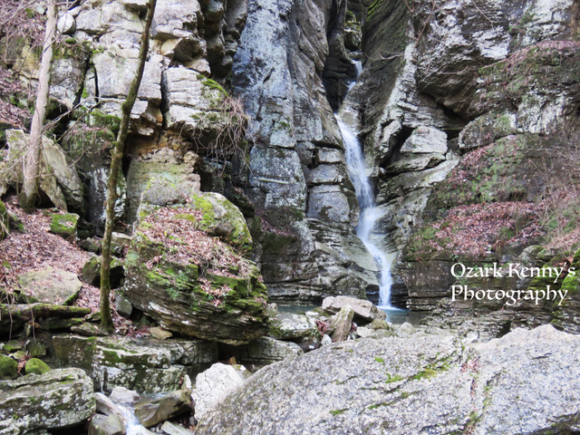
It was not to long from now that when I discovered the primary reason for the noted difficulty of this trail. Once we reached, what seemed to be the end of the low trail, we approached the eye of the needle from below. We still had cameras out so I was checking out the falls to the left and just sort of panning around the holler when I looked up to see the series of ropes that we were about to traverse. I was not expecting this...however, I was the first in line to give it a shot. My enthusiasm must have wanted to make an appearance.

Climbing that thing was exactly what a skateboarder would want out of a deep Ozark hike, and it was provided. After I reached the top, I spun around to watch Kenny and Dakota make the climb which also gave me a moment to take in how large the valley really was. It's amazing how much water erosion can cut away at rock over hundreds of millions of years.

Triumphant, we stood atop the ropes as we were about to walk up the Eye of the Needle, myself for the first time. With more mysterious erosion sights to be seen, I couldn't help but to stay in there for just a second and think that so many of these places would make a great shelter from a storm, either for a person or maybe a bobcat.

The next section was a couple of cool large boulders, which seemed to have been dropped into the creek, to climb over and it wasn't too long before we reached Eye of the Needle. Victory. We had made it to our destination, and possibly just as satisfying, lunch. Our longest break was easily the most enjoyable, to stand below the falls and just sit. The final pictures were taken and we were ready to make tracks back to Kyle's Landing.

Overall, I highly recommend this trail to any sure-footed hiker with a day to burn in the Ozark National Forest. The winter season made for open visuals but also contributed to the slippery trail. Dakota and I were able to snap the shots you've seen within the article but below, take a look at what Photographer Ozark Kenny was able to get out of out near-perfect day, hiking in Arkansas.
-


Comments